
以重庆市秀山土家族苗族自治县为例
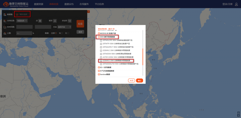
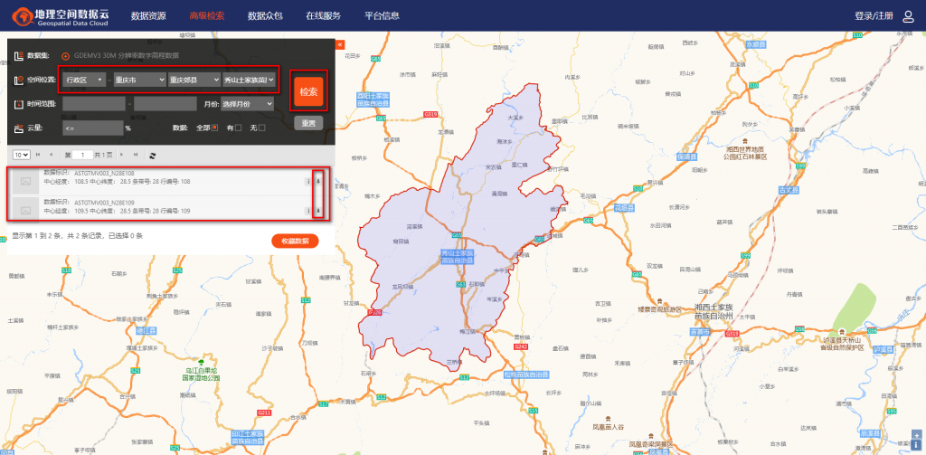
一、获取所需地区的dem
通过地理空间数据云获取秀山的dem
二、获取所需地区的shp文件
可以直接百度下载,但是网上公开的大多数都是只到县级的shp,如果需要乡镇级别的需要自行寻找,实在不行可以淘宝。但是数据肯定不是最新的边界,如果需要完全最新的,可以找网上对应区域的乡镇一级区划图,进行配准,可参考以下经验:https://blog.csdn.net/CaptainLJP/article/details/122129751
三、对获取的shp进行边界融合,后面依据这个融合的边界文件进行对dem的掩膜
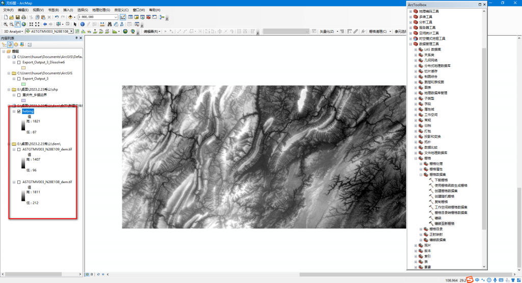
1、获取秀山县的shp
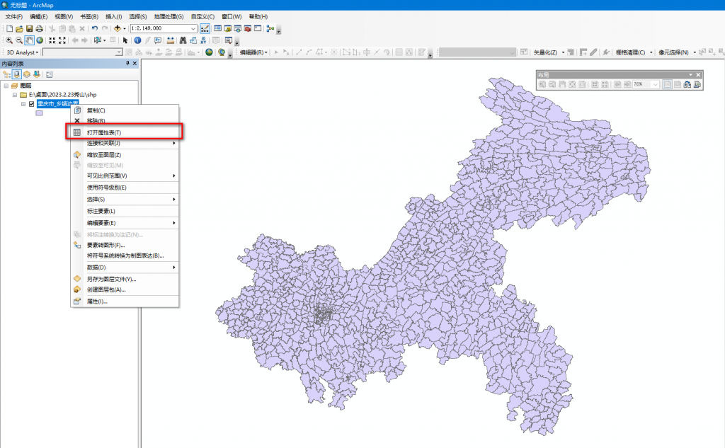
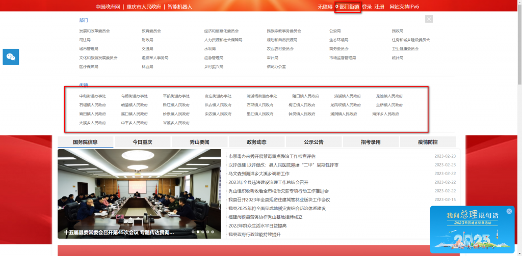
可以通过秀山政府网站查看详细乡镇街道名称,以便在重庆市乡镇级shp中选出秀山县乡镇shp另建shp
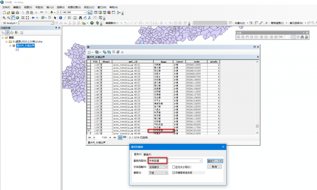
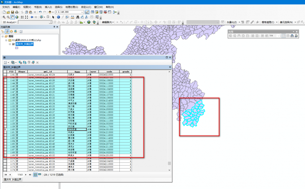
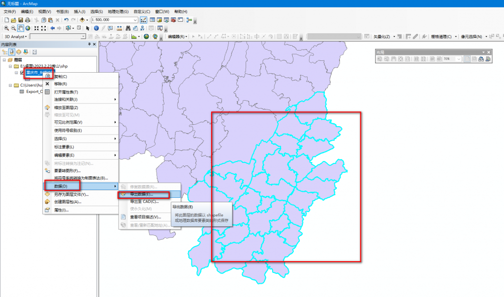
选中秀山县各乡镇后导出单独的秀山乡镇级shp
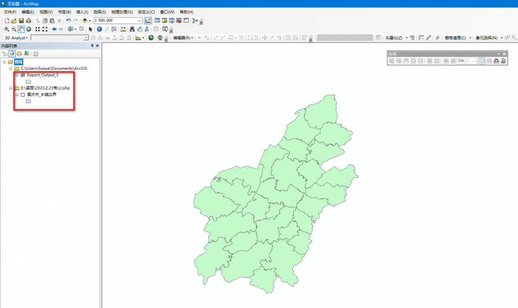
取消重庆市shp的勾选,只保留秀山的shp勾选,就能呈现只有秀山乡镇级的shp了
具体选中导出方法可参考链接https://blog.csdn.net/qq_41828818/article/details/120116767
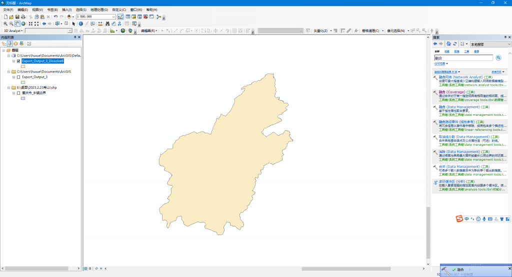
2、对秀山shp进行边界融合
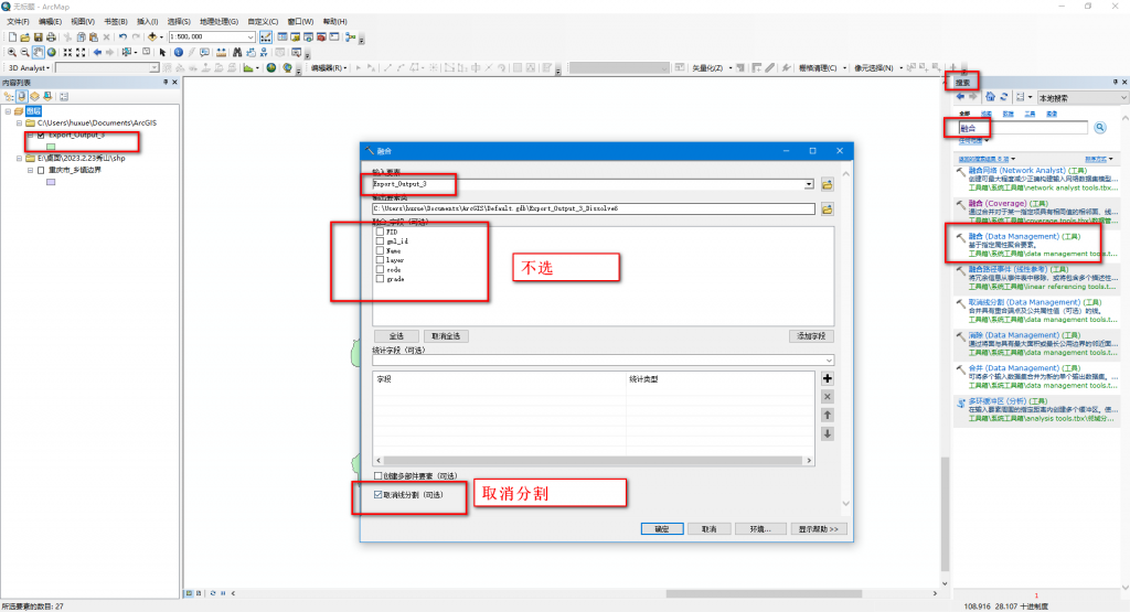
具体融合操作可参考链接https://blog.csdn.net/llliangliang/article/details/124920680
注意:我们需要的是边界shp,所以字段都不选,而且要取消各乡镇内部的分界线
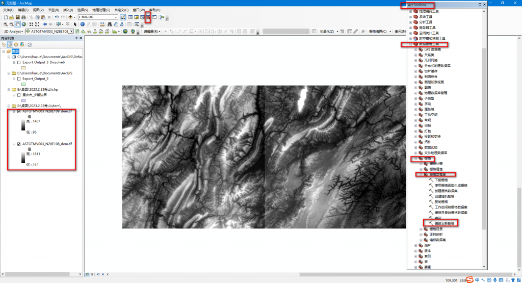
3、利用秀山县边界shp对下载的dem进行掩膜
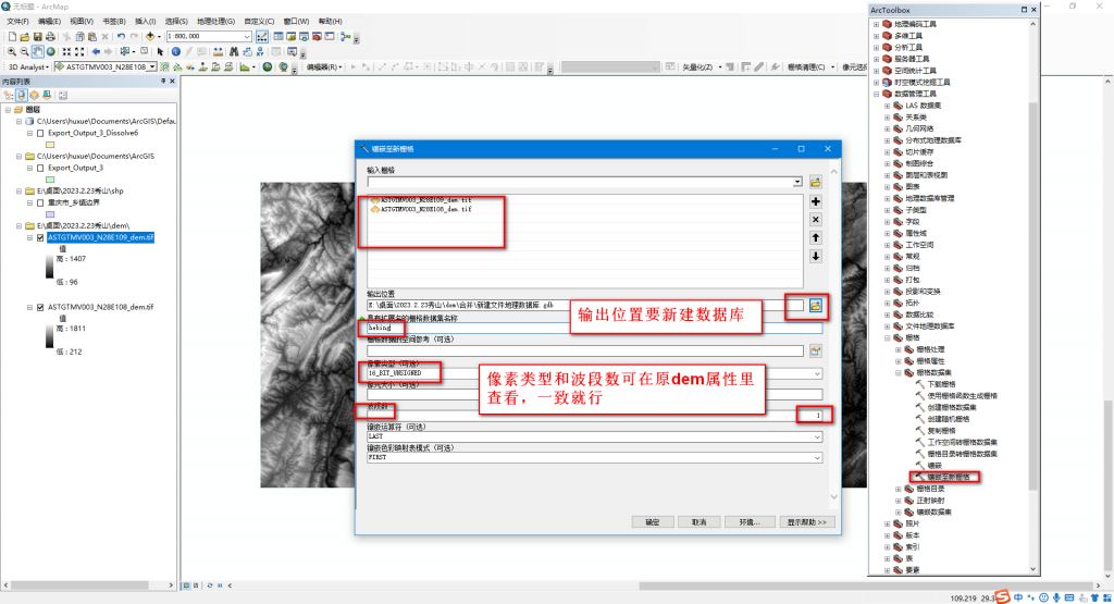
先对下载的dem各区块进行镶嵌合并
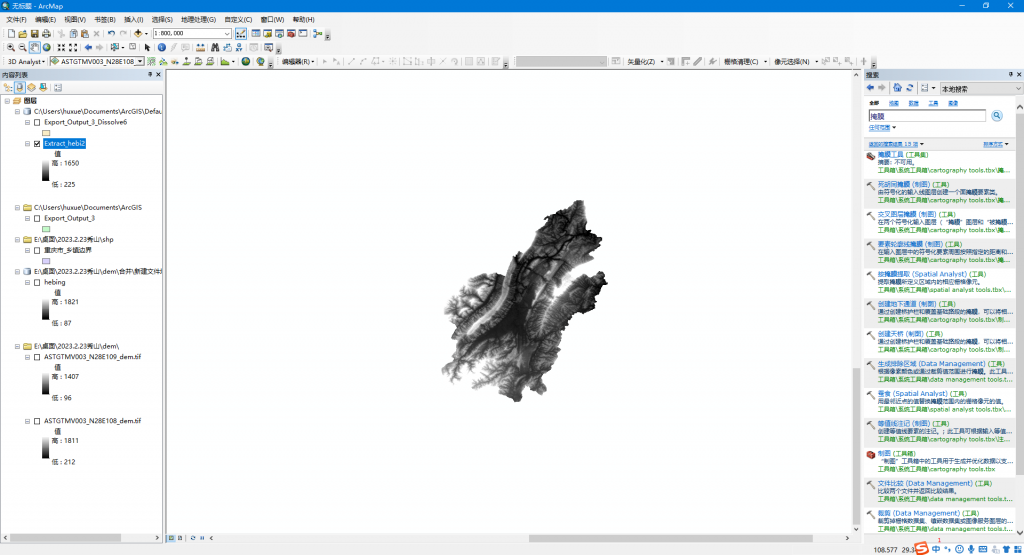
然后用秀山边界shp对刚才的合并后dem进行掩膜,获得秀山区域的dem
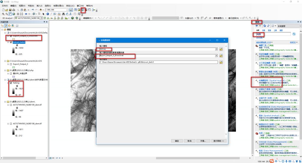
具体合并掩膜方法可参考链接https://zhuanlan.zhihu.com/p/336207432
四、显示符号图例等优化,逐渐满足自己的需要
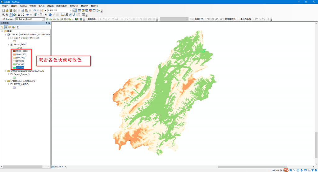
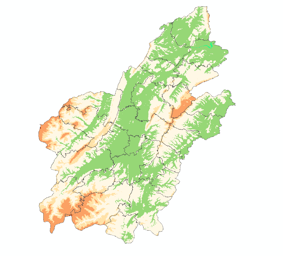
1、掩膜后的黑白dem改成常见的分层设色地形图
dem自带的海拔分割更改为常见的海拔
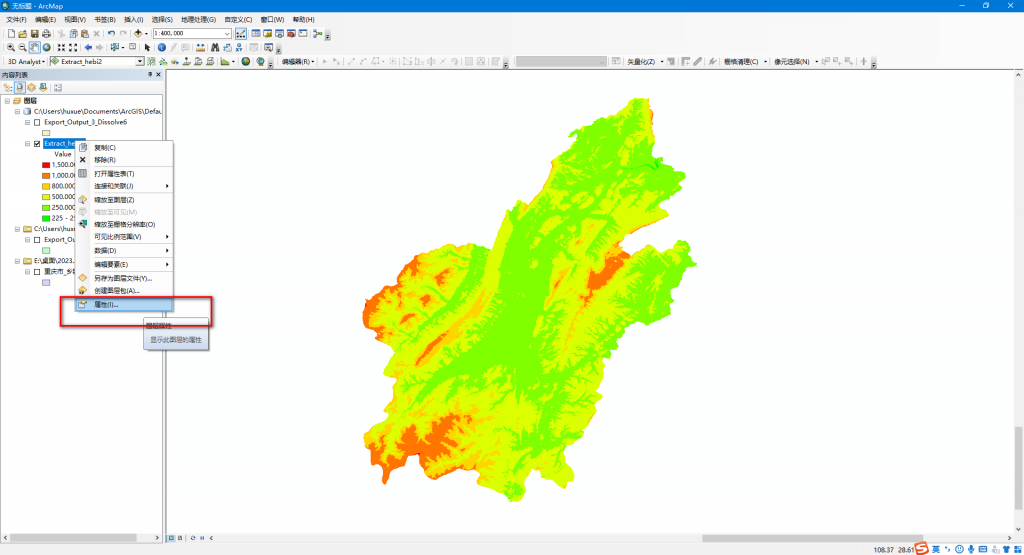
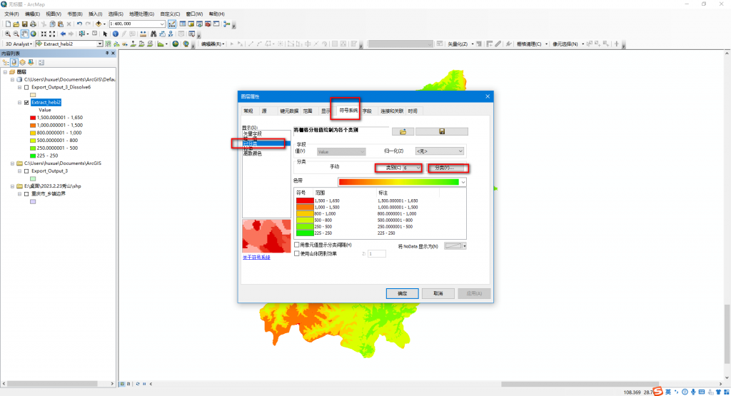
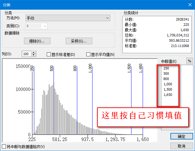
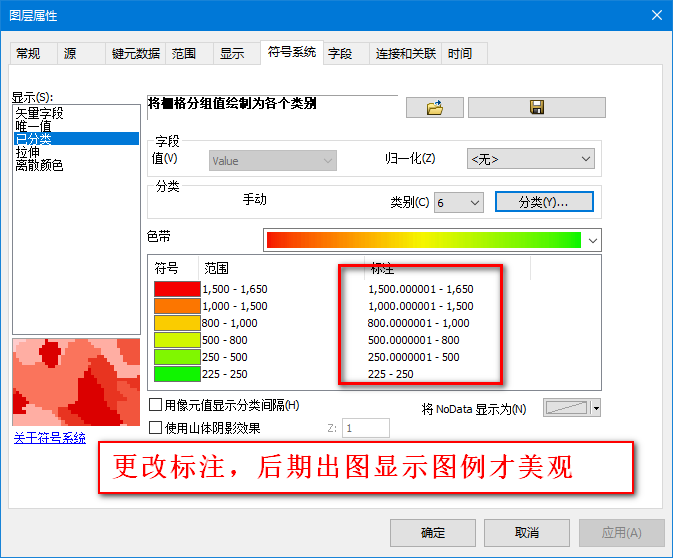
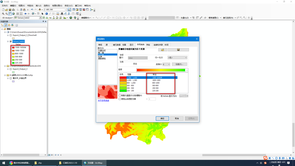
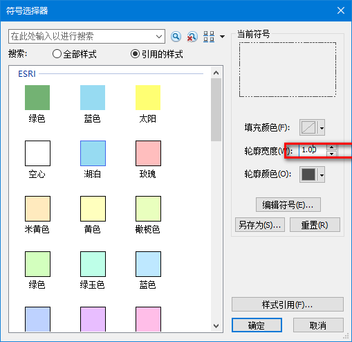
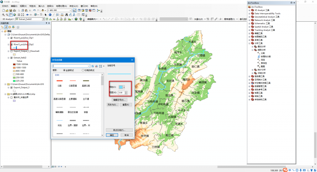
更改各海拔色带符号,可选一个喜欢的图例,用取色器查看RGB编码,一个一个更改,比如
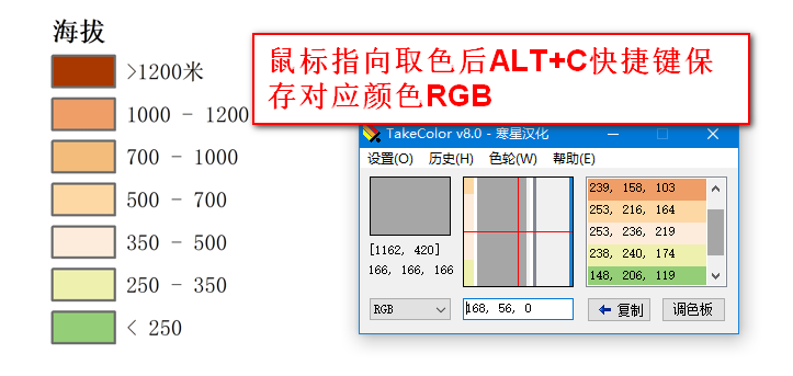
TakeColor取色器下载https://www.onlinedown.net/soft/39923.htm
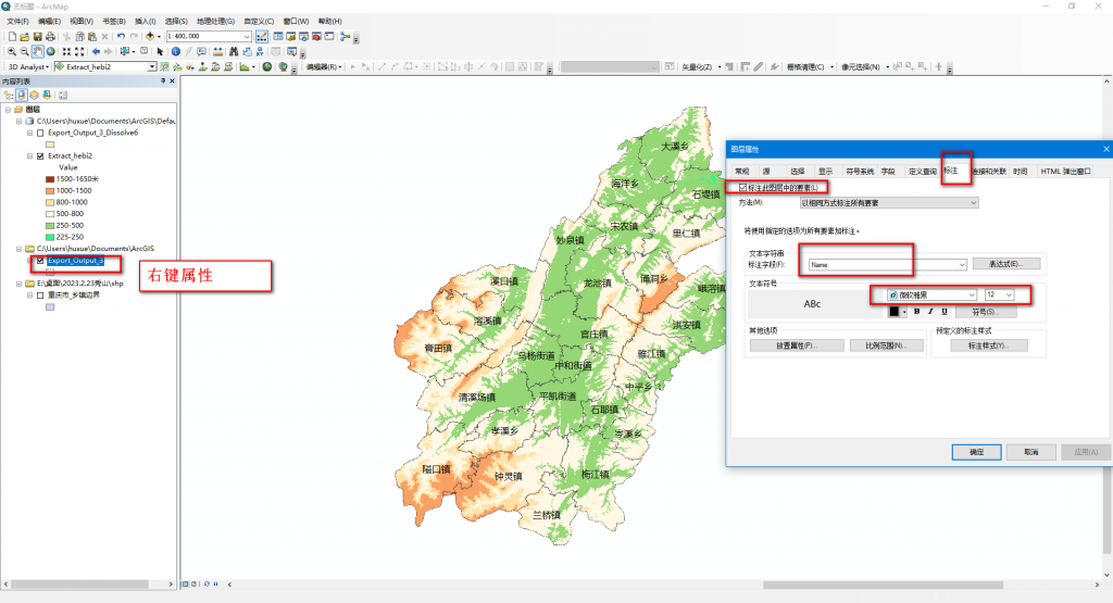
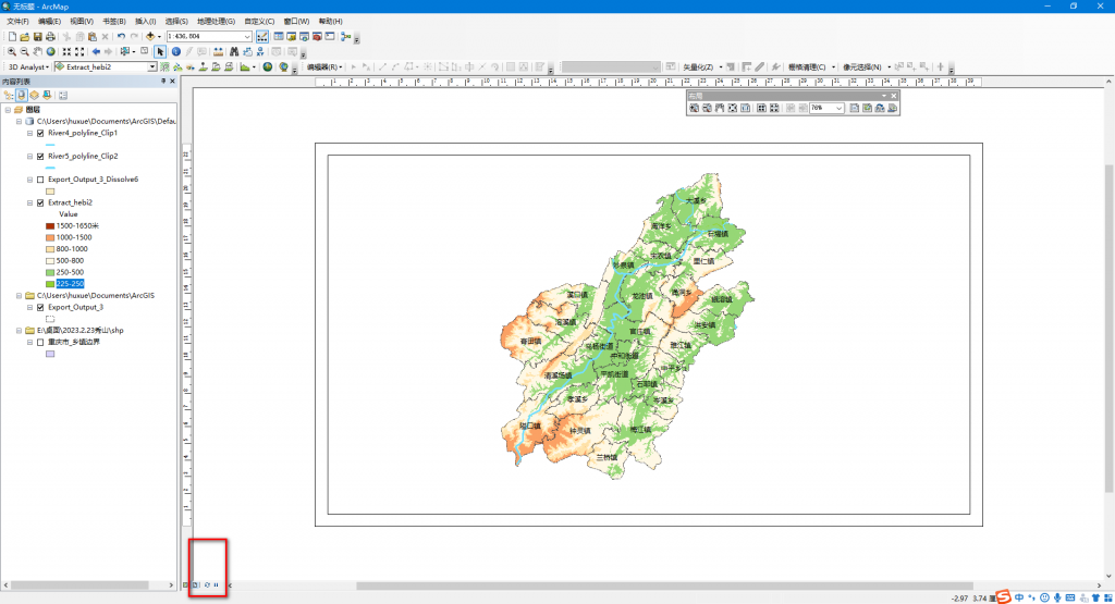
2、添加显示各乡镇名称和边界以及秀山县外框边界,准备布局视图,调整布局、图例等,以便后期出图
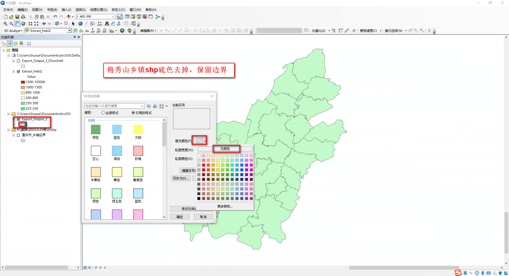
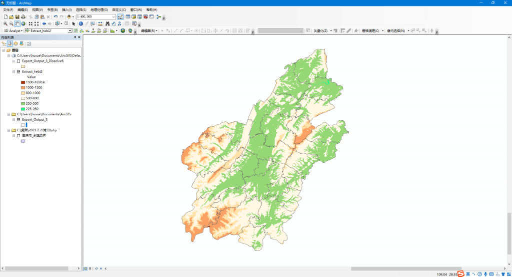
更改突出显示乡镇边界,显示乡镇名称标注
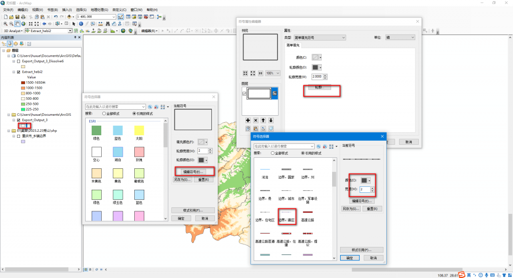
添加水系shp(百度下载全国水系矢量shp等方法),并按照秀山县shp对其裁剪。可能会裁剪失败,多尝试几次。

更改裁剪后的水系图例显示符号等,使其符合一般视觉效果
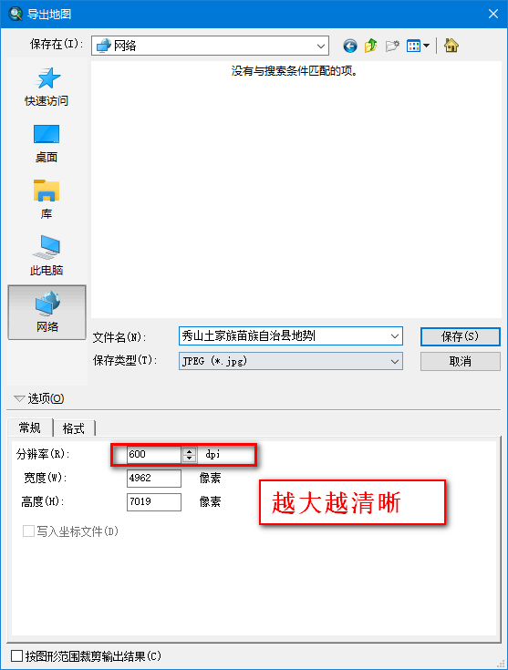
五、出图
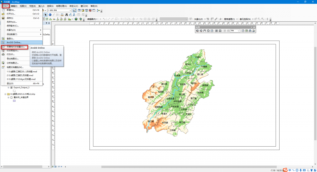
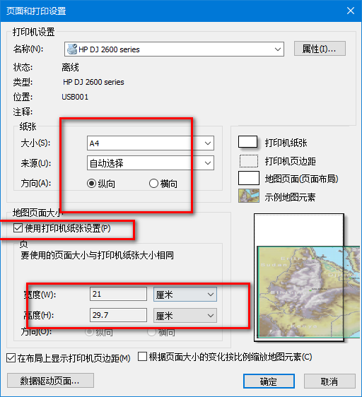
拖动地图至合适位置,并显示图例,添加图名,指向标、比例尺等
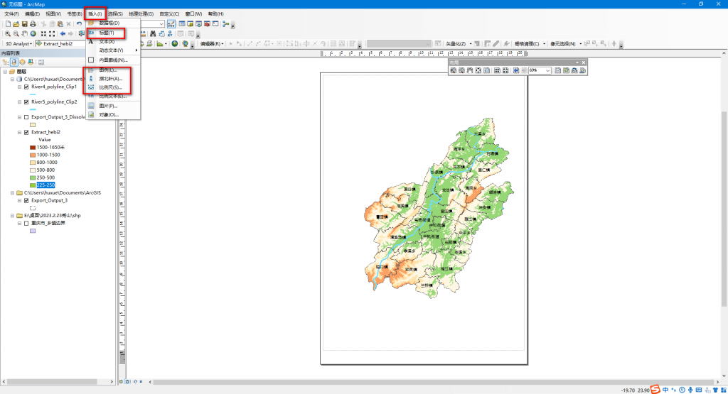
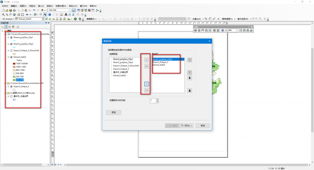
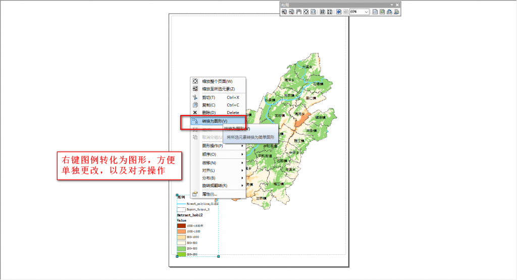
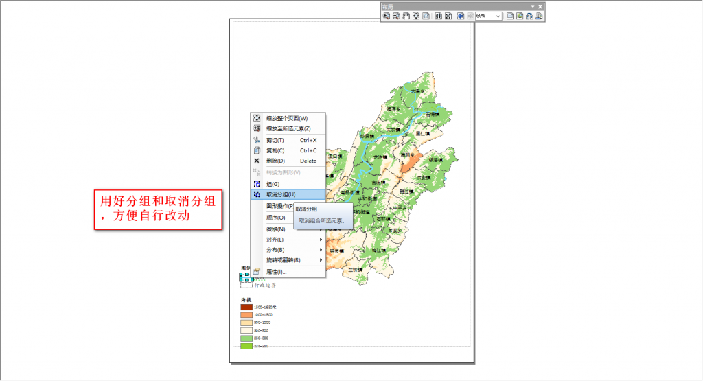
选择自己想要保留的图例符号

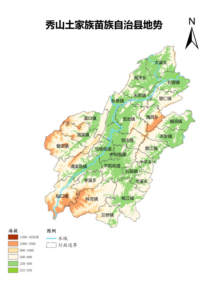
添加“秀山县在重庆市的图中图”(未完待续)
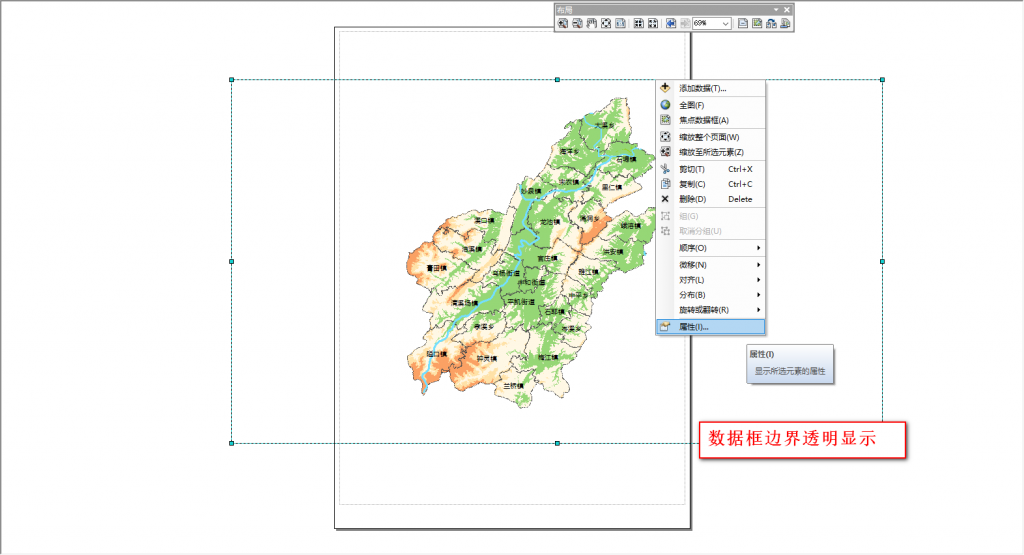
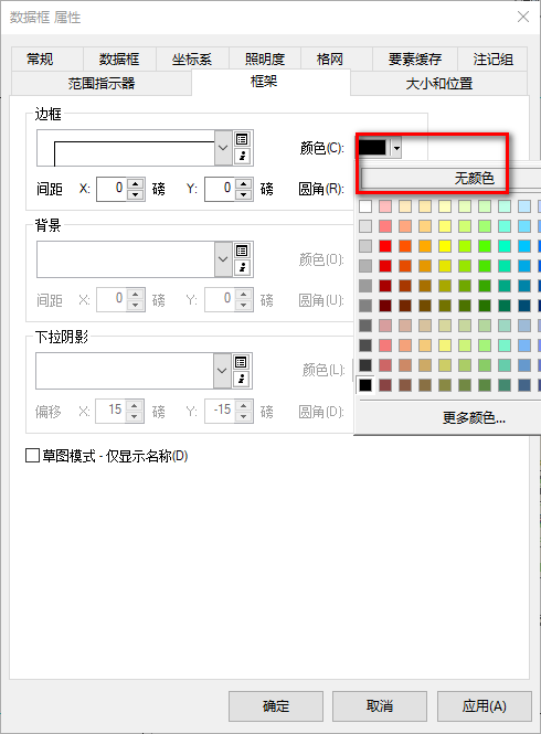
特别注意:如果后续在布局视图中添加多个数据框时,尽量不要数据框相互叠加重合,会造成打印出图时叠加部位的遮挡问题,就算各数据框都透明显示也无法解决,暂不知道什么原因o(╥﹏╥)o